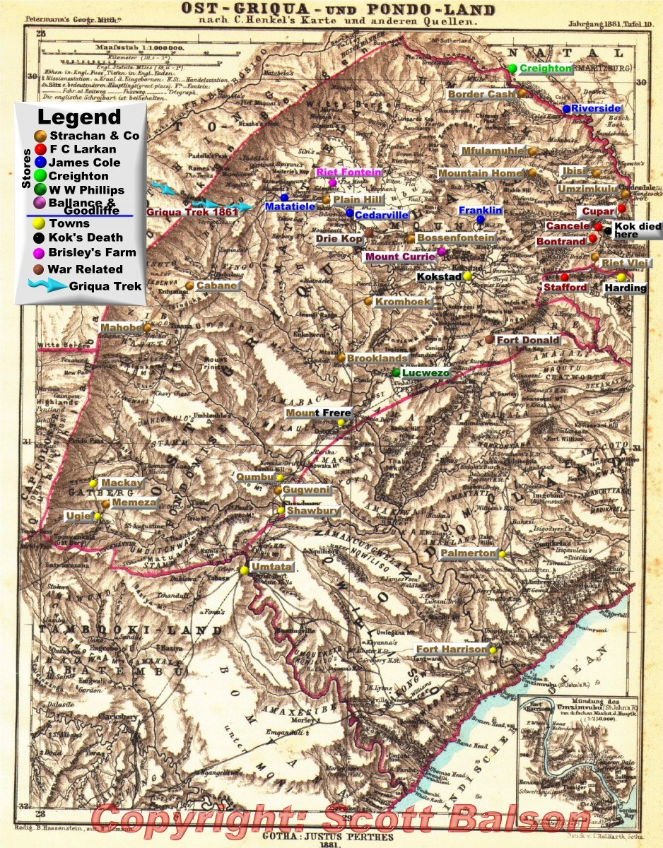
This German map of East Griqualand in 1881 has been superimposed with the location of Strachan and Co, James Cole and F C Larkan stores in this district as of 1915. In the 1870s and 1880s the Germans tried to establish a foothold in Pondoland, a small independent coastal strip bordered by East Griqualand to the west, Natal to the north and the Cape Colony to the south. Their efforts were foiled.
The map below is interactive and takes you back to related text elsewhere on this website (click on superimposed text). The Strachan and Co tokens were freely accepted as coinage for nearly sixty years (1874-1932) in all the towns, farms and regions noted on the map below.
The map clearly demonstrates the widespread location of the Strachan stores across East Griqualand and why their coinage was accepted as currency in this region and beyond - where colonial coinage was in extremely short supply.